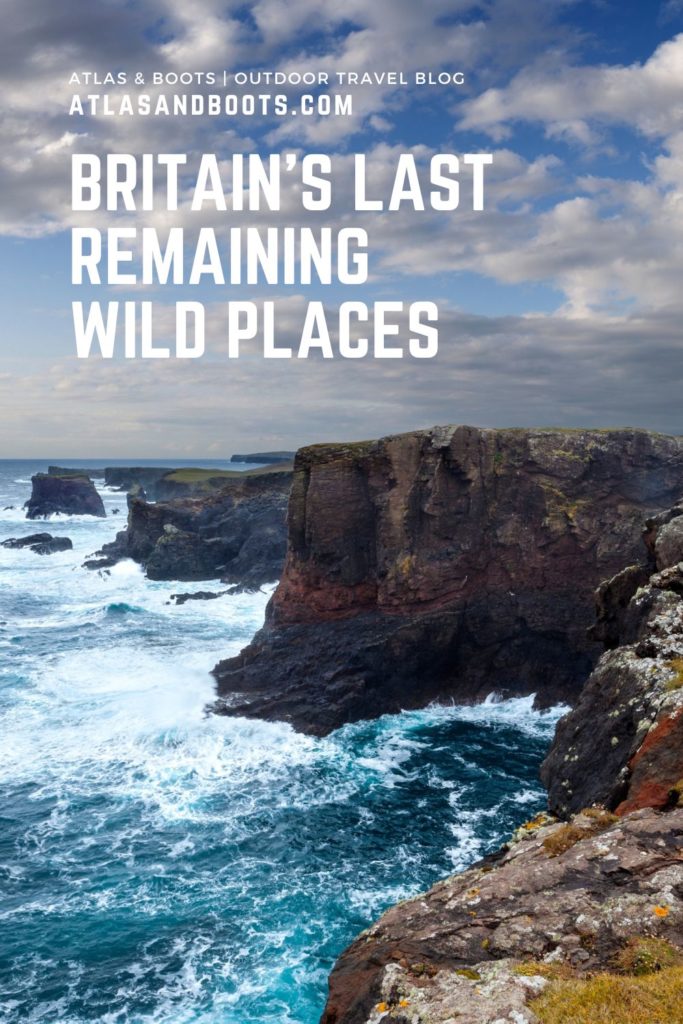
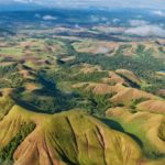
From desolate moorlands to windswept Atlantic islands, we take a look at Britain’s last remaining wild places
In Britain, wilderness has largely been abolished. The abolition began millennia ago. Between 7,000 and 5,000 years ago, around 75% of the UK was covered in forest. Then large-scale forest clearance started around 3100 BC when Neolithic agriculture was introduced. Now, the UK has around 13% forest cover, making it one of Europe’s least densely forested countries.
While we were deforesting our landscape, we were also hunting wild animals to extinction and turning their habitat into farmland. Wolves, lynx, bears, bison and moose are just a few of the mammals that once roamed Britain. Now, over 70% of the UK’s land has been turned over to agriculture. More than half of that is for the grazing of livestock alone.
The abolition continued apace during the Industrial Revolution and then the invention of the motor car. Only a small and ever-diminishing proportion of the UK’s terrain is further than five miles from a paved surface.
There are over 33 million cars in Britain, motoring along over 245,000 miles of roads. If those roads were laid continuously, you could drive to the moon. Roads cover around 0.9% of the country’s land area, but if you include the width of the land occupied by roads, including verges and hedgerows, the figure is closer to 1.3%.
Today, sixty-seven million people live in just 95,000 square miles of land and the country is now one of the most nature-depleted in the world – in the bottom 10% of nations globally – with almost half of the country’s biodiversity wiped out since the industrial revolution.
“We are now, in hard fact, on the bleak threshold of losing much of the old landscape. We have done unimaginably terrible things to our countryside. It is only here and there along our coasts and on the really high hills and mountains that the ancient richness of natural life is not yet in danger.”
– John Fowles, novelist, 1985
There are, however, still pockets of biodiversity to be found. Unsurprisingly, in the more remote areas of northern England, Scotland and Wales, biodiversity is more intact than in areas such as southeast England, where farming tends to be more intense and there are more people, towns and cities. And where you find biodiversity, you’re more likely to find an uncultivated, uninhabited landscape: aka wilderness.
Britain’s last remaining wild places
From the moorlands of southwest England to Scotland’s windswept northern islands, we take a look at Britain’s last remaining wild places.
Ynys Enlli, Wales
With a population of just 20,000, the Llŷn Peninsula in North Wales is already a quiet and remote part of the UK. But sitting around two miles (3.2km) off the peninsula’s tip is the tiny island of Ynys Enlli. The name means ‘islands of the currents’; appropriate given the fierce tidal races of the Irish Sea that converge around Enlli.
The island has been a place of pilgrimage since the early years of Christianity in the 6th century, but there are signs of settlements on the island that date from earlier. At one point, as many as 100 people lived on Enlli, now just 11 remain.
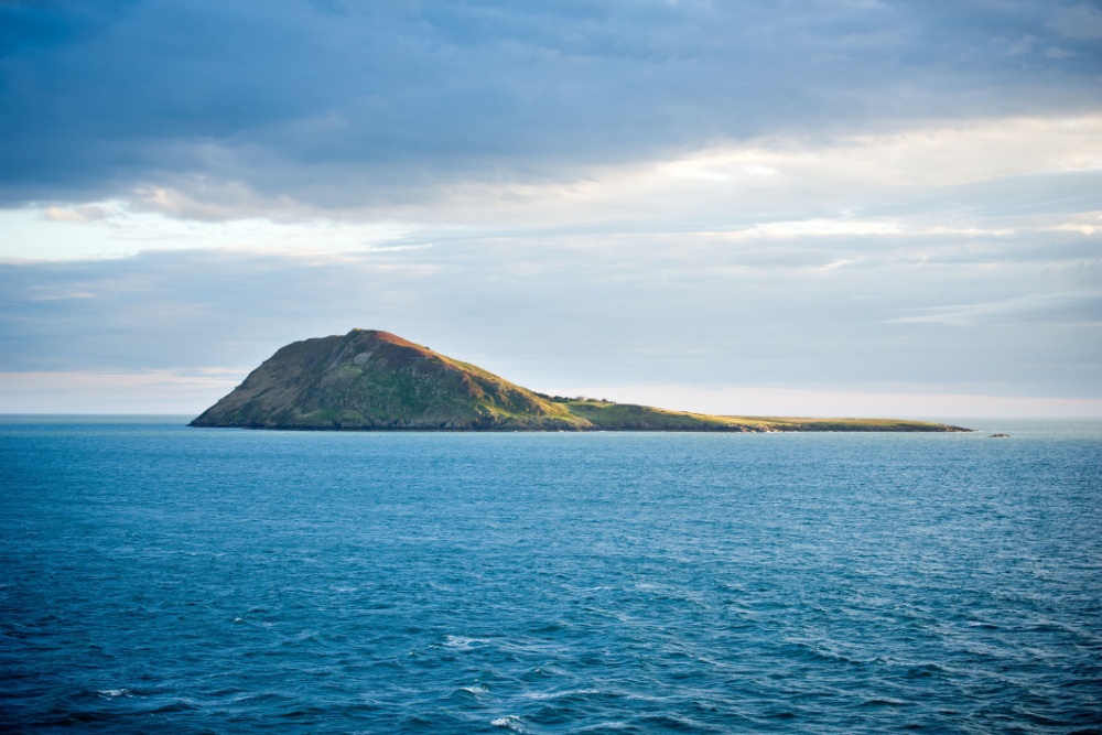
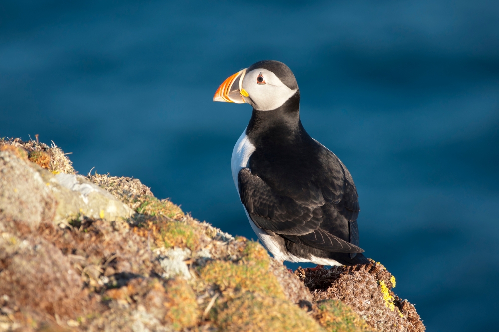
Undisturbed by modern farming practices, the island is home to rare plants and habitats which make it a haven for seabirds, including puffins, razorbills and Manx shearwaters which breed on the island.
The surrounding waters are a sanctuary for seals, dolphins and porpoises. The island also hosts several migratory bird species, as well as unique plant life due to its isolation and coastal environment. Ynys Enlli is an important spot for both birdwatchers and nature enthusiasts.
The Rhinogs, Snowdonia, Wales
Don’t be put off by the queues, carparks and trains on Snowdon – the wider national park is still one of the least densely populated areas in England and Wales and one of Britain’s wildest landscapes.
To the south of one of Britain’s most popular mountains are the rugged, bony peaks of the Rhinogs looming over remote Atlantic rainforest, precipitous gorges and lofty tarns while the Irish Sea flashes on the horizon.
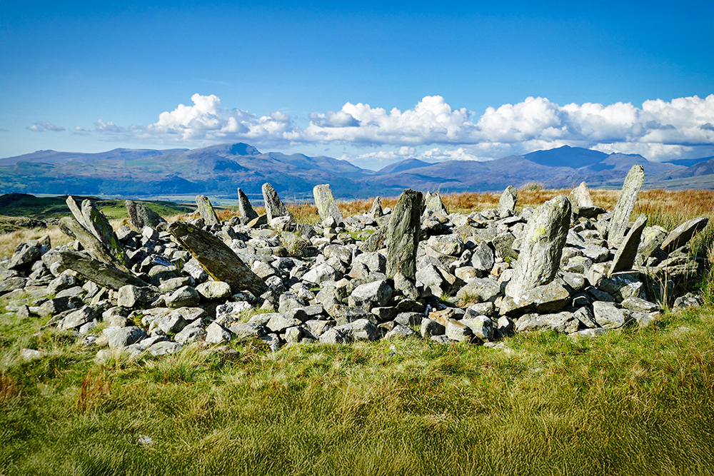
Striking geography aside, there are the devilish pillars of the Crown of Thorns, AKA Bryn Cader Faner. Looking like something out of Game of Thrones, the surreal bronze-age stone circle is thought to be a prince’s burial cairn. The ancient inhabitants have long since moved on, instead, a population of feral goats roam the range.
The Sperrins, Northern Ireland
The sprawling Sperrin Mountains of Ulster are a rugged land. The largest sheets of the last ice age shaped these peaks into smooth, waving ridges that flutter like streamers across the skyline. But don’t be fooled by these mountains’ delicate curves – the Sperrins are bleak, barren and wild.
Peppered with dark forests, peat bogs and thick coarse grass and heather, this is a landscape not easily traversed. Overhead, ravens and buzzards soar while rare red squirrels and pine martens shelter in pockets of forest. Other than that, it is a lonely, wild place.
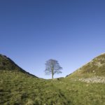
The Northern Fells, Lake District, England
Many would argue, with good reason, that the Lake District, Britain’s busiest national park, is the antithesis of wilderness. The hills have been reshaped by mining; the forests long since felled; the hillsides used for livestock grazing; its world heritage status is under threat from the volume of 4×4 vehicles; and the park’s roads are gridlocked by the 19 million annual visitors. Even some of the lakes of the Lakes are artificial – the reservoirs of Thirlmere and Haweswater were created to provide the city of Manchester with water.
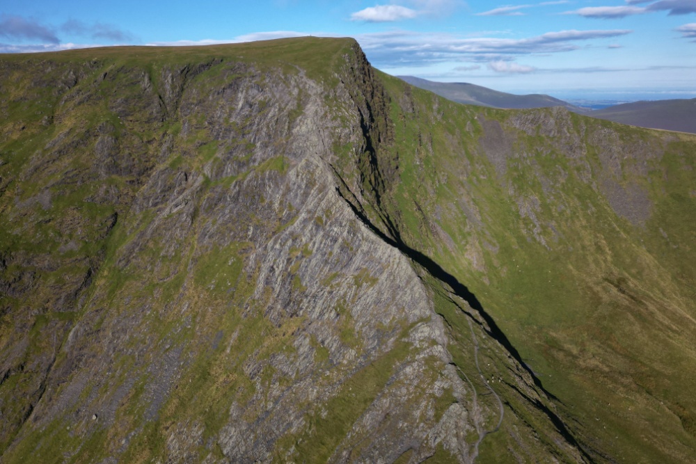
But in the far north of the park, where there are no roads, no lakes and barely any people, the fells swoop and bulge and look more like Scotland than England. The Northern Fells occupy around 100km2 which is home to some of the most isolated terrain in northern England. There’s even a remote bothy hidden in the craggy, isolated, valleys. I could tell you where but wouldn’t want to spoil the quest.
Kielder Water, Northumberland, England
Okay, so Kielder Water is the biggest manmade lake in Northern Europe and it is home to England’s largest hydroelectric plant and it is surrounded by Kielder Forest, one of the biggest manmade woodlands in Europe but Kielder is a fine example of what can be achieved when it comes to reversing the damage we’ve done.
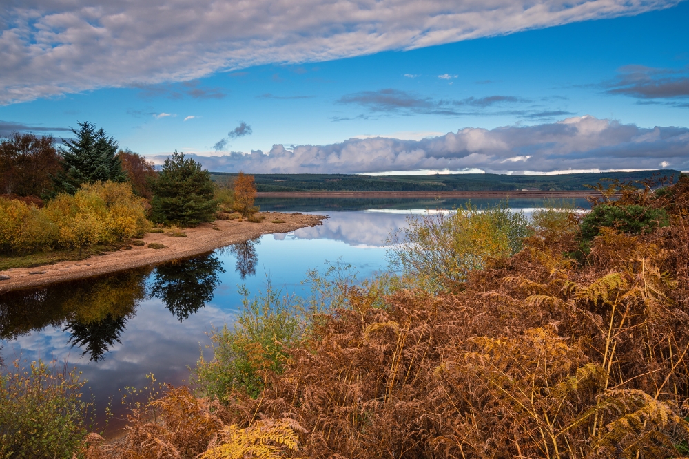
When the development was completed in 1981, buildings, homes and roads had been replaced with water which is now a thriving natural habitat for wildlife including badgers, deer, otters, red squirrels, shrews, seven species of bat, numerous species of woodland birds and several birds of prey including ospreys.
It is estimated that around 85% of people in the UK have never seen a truly dark sky. The Kielder region is officially the darkest place in England – the Northumberland International Dark Sky Park is the largest of its kind in Europe. Kielder may just be Britain’s most successful rewilding project.
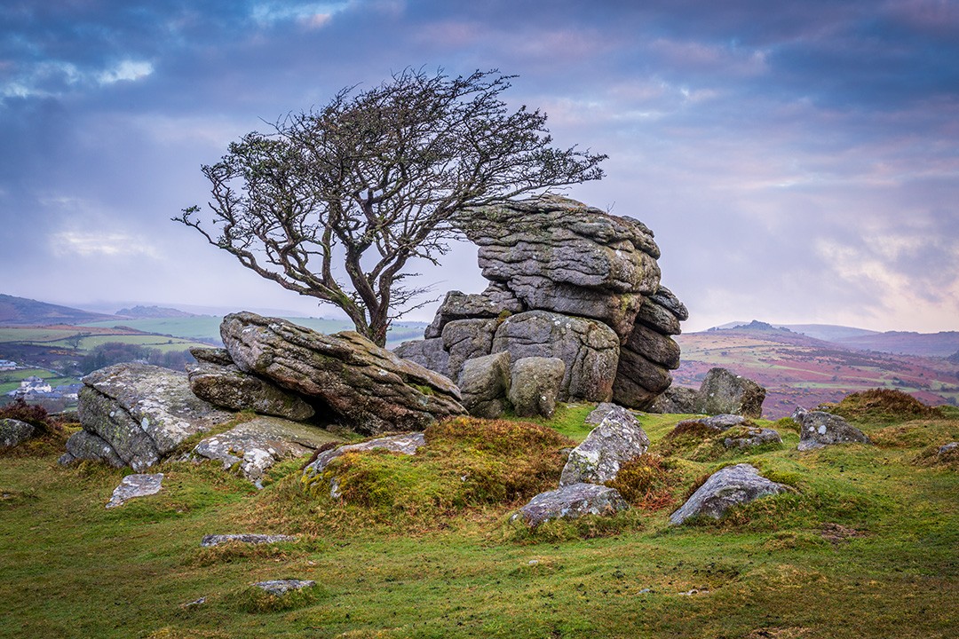
Duck’s Pool, Dartmoor, England
I’ve always been fond of Dartmoor. I first visited as a child on a family holiday and I’ve returned regularly ever since, most recently to complete the Two Moors Way. Famous for its wild ponies, open moorland and craggy granite tors (free-standing rocky outcrops that rise abruptly from the surroundings), it is one of the few authentically wild places left in England.
And, despite the recent best efforts of a hedge fund manager with too much time on his hands and money in his bank, it is the only place in England where you can legally wild camp.
While northern Dartmoor is greener, hillier and arguably more beautiful, the south is vast open moorland with no one around. Duck’s Pool is a small depression set in a remote part of an already remote landscape. Among Duke of Edinburgh groups, it’s known as the Bermuda Triangle because it’s not unusual to get lost there. It’s boggy, featureless, frequently misty and absolutely wild.
Isles of Scilly, England
Continue west from Dartmoor to the gnarly granite cliffs at the westernmost point of mainland England. Then, keep going, out to sea, past Longships Lighthouse, to the Isles of Scilly. Here, is perhaps the most un-English place in England. The beaches are Caribbean-worthy, the countryside lush and the ocean, stunningly clear. But most un-English of all is the weather. The Isles of Scilly have their own microclimate where the average annual temperature is 12.0°C, making it the warmest place in the British Isles.
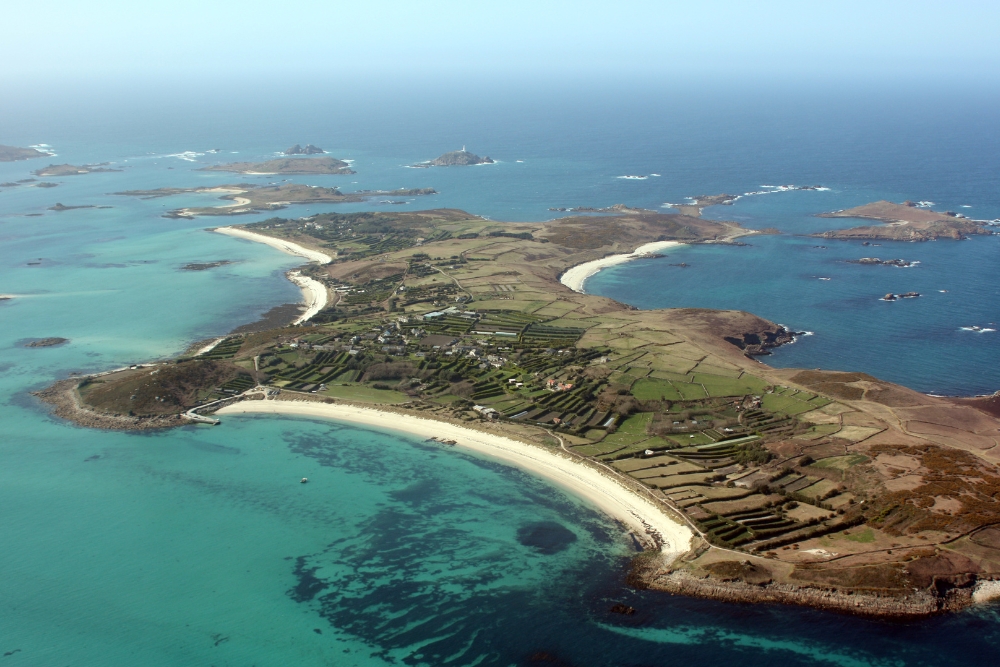
But if this all sounds too comfortable, remember that there are over 140 islands in this remarkable archipelago and only five of them are inhabited. Even the five populated ones only accommodate a smidge over 2,100 people. But getting off the tourist path isn’t easy. To truly escape civilisation, you’ll need a boat or, as the islands are relatively close together, a sea kayak, which only adds to the allure of exploring one of Britain’s last remaining wild places.
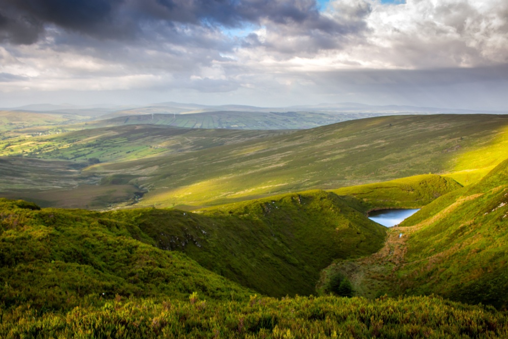
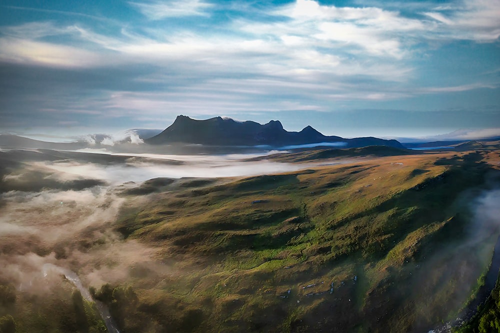
Rannoch Moor, the Highlands, Scotland
Glen Coe is one of Britain’s most picturesque landscapes and is a popular destination as it’s only not far from Fort William. However, it is big enough to feel properly wild, especially on the vast and empty Rannoch Moor which provides a contrasting and desolate backdrop to the moody mountains, especially the imposing Buachaille Etive Mòr.
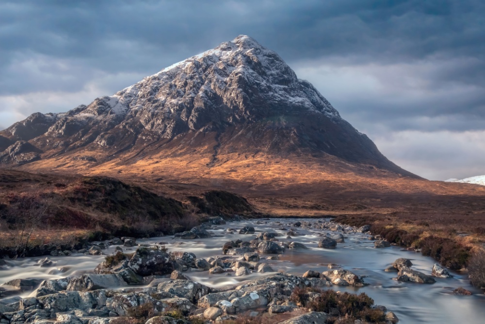
The lower levels are often boggy moorland, probably why it’s not as popular as other spots in the Glen Coe area. But the area is vast and varied and you’ll also find countless lochans (ponds), rivers and rocky outcrops which support an embarrassment of plants, insects, birds and animal life including curlews, grouse and deer.
Handa Island, Scotland
The only other place I’ve seen as many birds as Handa Island is the cliffs of Alkefjellet in Svalbard – in the Arctic – which are home to approximately 60,000 pairs of Brunnich’s guillemots. While not as remote, Handa Island shares many characteristics with Alkefjellet: dramatic, towering cliffs, a tempestuous ocean and, tens of thousands of seabirds.
The wild island is a significant breeding site for guillemots, great skuas, puffins and razorbills that arrive en masse in summer to breed and feed in the fish-rich waters surrounding Handa. Those waters also attract larger marine species including minke whales, dolphins, grey seals and even an occasional orca and basking shark.
Just 2,000 people visit the island a year so you’re practically guaranteed seclusion. The island is a nature reserve managed by the Scottish Wildlife Trust. While the Trust acknowledges the ‘right to roam’ everywhere in Scotland, they don’t encourage camping on Handa Island. Likewise, dogs are not permitted on the island. Daily ferries run round trips to the island from Tarbet on the mainland.
Flow Country, Scotland
In July 2024, the UNESCO World Heritage Committee inscribed the Flow Country as a World Heritage Site. The Flow Country is an extensive and unspoiled blanket bog (an area of peat that forms in cool, wet climates where plant remains accumulate instead of breaking down) in the far north of Scotland. It is the planet’s largest such bog and is the first peatland to be designated by UNESCO following a 40-year campaign by environmentalists.
With peat as deep as 15 metres in places, it’s hardly surprising that footfall is low in this part of remote Scotland. While peatlands are low in nutrients, so are not known for their high levels of biodiversity compared to other ecosystems, plants are abundant including the vibrant pink and white flowers of bogbean, carnivorous sundew, yellow-flowered bog asphodel and sphagnum moss. The area also supports dragonflies and rare bird species such as the dunlin, golden plover and red-throated diver.
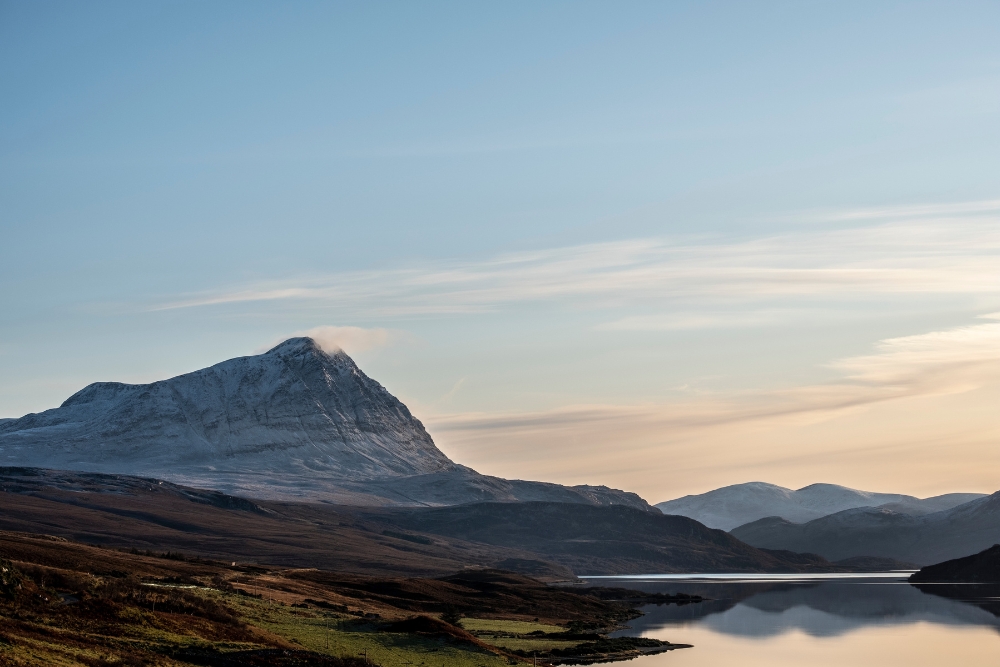
The Flow Country is also home to Ben Hope, the northernmost Munro. It is speculated that if you climb Ben Hope on the summer solstice, and spend a clear night at its summit, you will never lose sight of the sun. The combination of its latitude and elevation means the uppermost rim of the sun never dips fully below the horizon. It is, unfortunately, apocryphal. Its 900m altitude will only give you around 10 minutes or so of extra sunlight. Still, it’s a wild idea, isn’t it?
The Outer Hebrides, Scotland
The Outer Hebrides or Western Isles are a 130-mile-long archipelago lying off the northwest coast of Scotland. There are over 100 islands and islets but only 15 of them are inhabited. Around 27,000 people call the islands home, but most of them live on the six main inhabited islands. That leaves a lot of wild to explore.
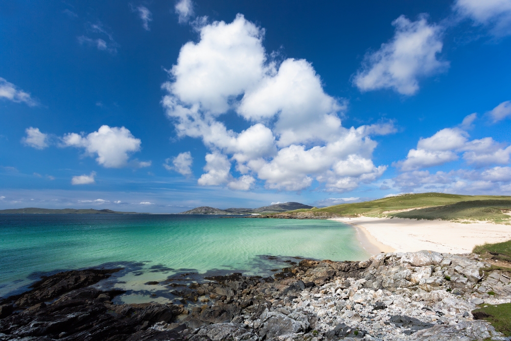
The beauty in this genuine British backcountry is relentless. The isles are famed for their wide Atlantic vistas, sandy beaches routinely named among the best in the world, sea-to-summit mountains, mystical standing stones, Gaelic culture and machair – a rare grassland habitat only found on the exposed west-facing shores of Scotland and Ireland.
Wildlife encounters in the Outer Hebrides are not rare, on land and at sea. It’s possible to see otters and red deer and hundreds of bird species including golden eagles, white-tailed sea eagles, peregrine falcons, merlins, corncrakes and puffins. In the surrounding waters, don’t be surprised to spot porpoises, orca whales, minke whales, basking shakes and numerous species of dolphins.
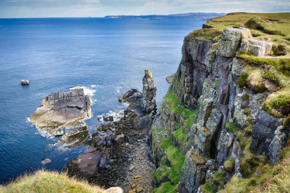
The Northern Isles, Scotland
Lying off the northern tip of Scotland are the Northern Isles, made up of the two main island groups of Orkney and Shetland, both of whose history is inseparably linked with Scandinavia. Both groups also share similarly striking scenery, spectacular wildlife and vast tracts of backcountry.
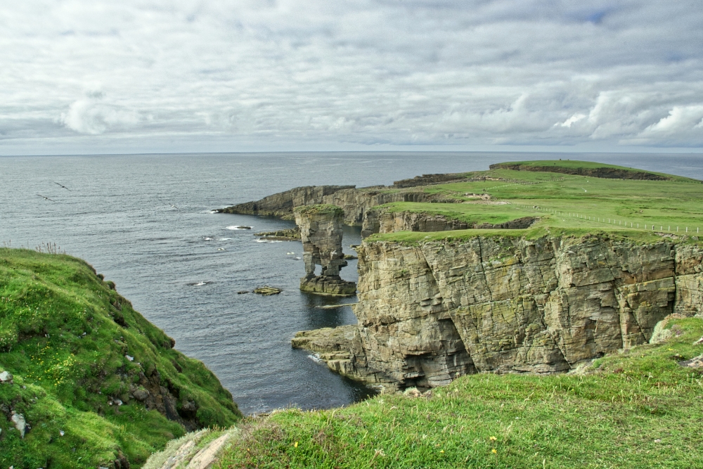
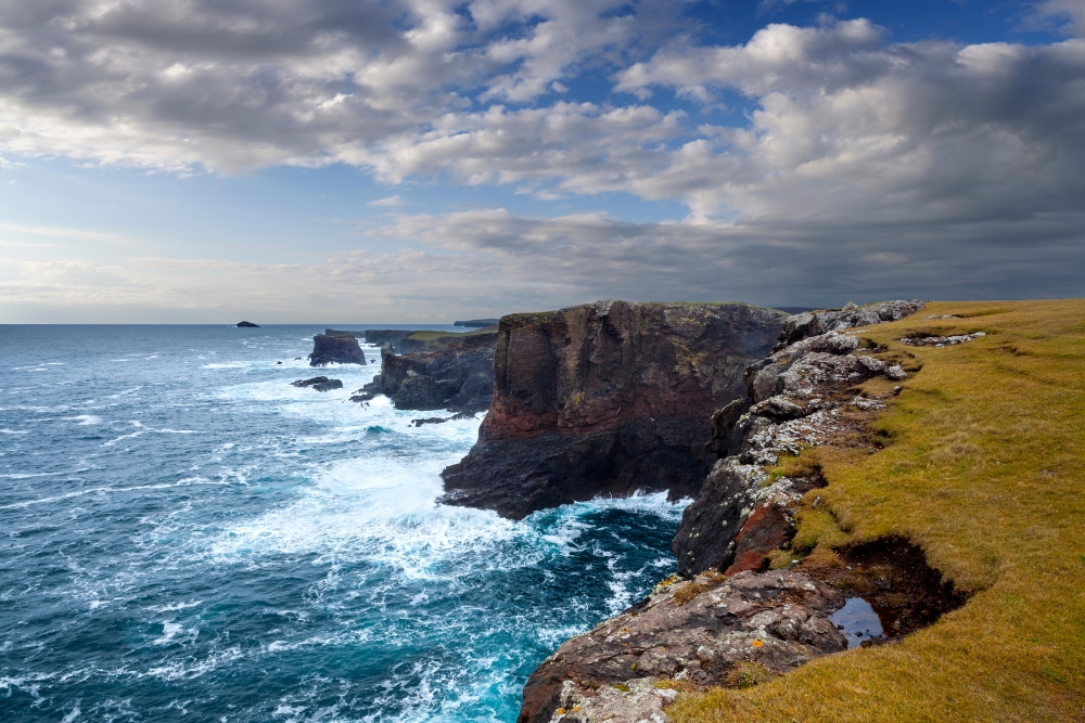
The landscape this far north is ancient. Millions of years ago, this part of the world was, in fact, closer to the South Pole. As such, the landscape is startlingly beautiful, boasting soaring sea stacks, towering cliffs pockmarked with explosive blowholes, long sandy beaches, heather-clad moorland and wide glacial valleys.
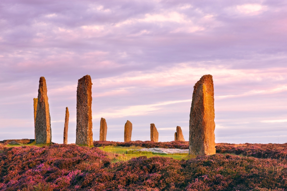
Closest to Scotland are the Orkney Islands with their UNESCO-listed neolithic heritage sites dating back 5,000 years. The archipelago is made up of around 70 islands, of which 20 are inhabited.
Around 50 miles (80km) to the northeast of Orkney Islands are the Shetland Islands. Made up of around 100 islands of which 16 are inhabited, the Shetlands are Britain’s final outpost and share many similarities in topography and culture to the Orkneys.
All that lays beyond these windswept lumps of rock are the Faroes, Iceland and the Arctic. As such, this distant archipelago endures the most volatile weather in the UK. During summer, however, the ‘simmer dim’ – the twilight which lingers through the small hours at this latitude – is what makes Britain’s final wilderness so magical.
Enjoyed this post? pin it for later…