The highest mountains in the Yorkshire Dales are home to some of England’s finest and wildest scenery, all of it ripe for hiking
Covering 2,179km2 of countryside, Yorkshire Dales National Park showcases some of England’s best outdoor landscapes. The park’s glacial valleys are defined by a unique terrain of high heather moorland, rolling hills and dramatic waterfalls, all criss-crossed with miles of dry stonewalls and delightful villages.
The park attracts over 3.5 million visitors every year looking to explore the scenery be it by foot, cycle or kayak – just a few of the options. The park is also home to some of England’s highest mountains: 41 to be precise. These offer a variety of challenges for hill walkers and showcase some of the best views in the Yorkshire Dales.
We take a look at the highest mountains in the Yorkshire Dales – 41 sterling reasons to go hiking in England.
When does a hill become a mountain?
In the UK, 610m (2,000ft) is generally accepted as the benchmark height for when a hill is promoted to the lofty ranks of a mountain. Until recently, the Yorkshire Dales were home to 40 such landforms.
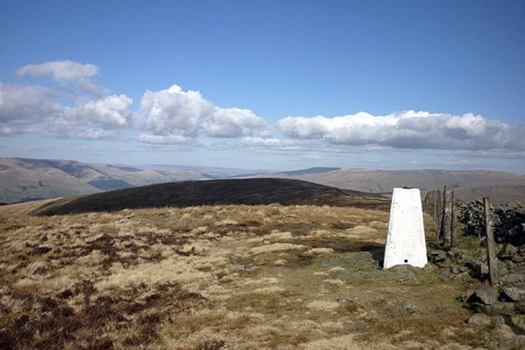
In 2016, Calf Top, a rather unremarkable hill in the northern Dales, was re-categorised as a mountain. In 2010, Ordnance Survey measured the hill at 609.579m (1999.9ft), slightly under the threshold required to be a mountain.
However, in 2016, improvements in Ordnance Survey’s process of calculating height showed the summit of Calf Top to be 609.606m (2000.02ft), slightly above the threshold. Calf Top became England’s newest mountain and the 41st mountain of Yorkshire Dales National Park.
The Dales 30
In the UK, just like throughout the world, there are several different methods of categorising a mountain. The elevation, prominence and isolation of a summit all come into play. There are numerous lists available: Marilyns, Munros, Majors and Nuttalls to name but a few.
When we first moved to the Dales we attended an evening at the Richmond Walking & Book Festival where local hiking guide Jonathan Smith from Where2walk discussed his book, The Dales 30.
The Dales 30 are the 30 summits in the Yorkshire Dales over 610m (2,000ft) that have a drop (prominence) of at least 30m (98.4ft) on all sides – another popular mountain classification method known as the Hewitts (Hills in England, Wales and Ireland over two thousand feet).
Jonathan has written a detailed Dales 30 companion guidebook filled with recommended routes, maps, facts and anecdotes. I started with hiking Great Shunner Fell, my first Dales 30 and the third highest on the list. Fast forward a few months and I’ve now ticked 18 mountains off the list.
Highest mountains in the Yorkshire Dales
The map below plots the 41 mountains in the Yorkshire Dales in blue and the Dales 30 mountains in red. Use the sidebar to hide or reveal each list.
The table lists the 41 mountains in Yorkshire Dales National Park in order of height.
| Rank | Mountain | Height | Dales 30 |
|---|---|---|---|
| 1 | Whernside | 736m (2,415ft) | ✓ |
| 2 | Ingleborough | 724m (2,375ft) | ✓ |
| 3 | Great Shunner Fell | 716m (2,349ft) | ✓ |
| 4 | High Seat | 709m (2,326ft) | ✓ |
| 5 | Wild Boar Fell | 708m (2,323ft) | ✓ |
| 6 | Great Whernside | 704m (2,310ft) | ✓ |
| 7 | Buckden Pike | 702m (2,303ft) | ✓ |
| 8 | Gregory Chapel | 695m (2,280ft) | |
| 9 | Pen-y-Ghent | 694m (2,277ft) | ✓ |
| 10 | Hugh Seat | 689m (2,260ft) | |
| 11 | Great Coum | 687m (2,254ft) | ✓ |
| 12 | Crag Hill | 682m (2,237ft) | |
| 13 | Swarth Fell | 681m (2,234ft) | ✓ |
| 14 | Plover Fell | 680m (2,231ft) | ✓ |
| 15 | Baugh Fell, Tarn Rigg | 678m (2,224ft) | ✓ |
| 16 | Knoutberry Haw | 676m 2,218ft) | |
| 17 | The Calf | 676m (2,218ft) | ✓ |
| 18 | Lovely Seat | 675m (2,215ft) | ✓ |
| 19 | Calders | 674m (2,212ft) | ✓ |
| 20 | Bram Rigg Top | 672m (2,205ft) | |
| 21 | Great Knoutberry Hill | 672m (2,205ft) | ✓ |
| 22 | Rogan’s Seat | 672m (2,205ft) | ✓ |
| 23 | Water Crag | 668m (2,192ft) | |
| 24 | Dodd Fell Hill | 668m (2,192ft) | ✓ |
| 25 | Fountain’s Fell | 668m (2,192ft) | ✓ |
| 26 | Little Fell | 667m (2,188ft) | ✓ |
| 27 | Great Dummacks | 663m (2,175ft) | |
| 28 | Fountains Fell South Top | 662m (2,172ft) | |
| 29 | Nine Standards Rigg | 662m (2,172ft) | |
| 30 | Simon’s Fell | 656m (2,133ft) | ✓ |
| 31 | Yockenthwaite Moor | 643m (2,110ft) | ✓ |
| 32 | Fell Head | 640m (2,100ft) | ✓ |
| 33 | Yarlside | 639m (2,096ft) | ✓ |
| 34 | Green Hill | 628m (2,060ft) | |
| 35 | Gragareth | 628m (2,060ft) | ✓ |
| 36 | Darnbrook Fell | 624m (2,047ft) | ✓ |
| 37 | Randy Gill Top | 624m (2,047ft) | ✓ |
| 38 | Bush Howe | 623m (2,044ft) | |
| 39 | Drumaldrace / Wether Fell | 614m (2,014ft) | ✓ |
| 40 | Birks Fell | 610m (2,001ft) | ✓ |
| 41 | Calf Top | 610m (2,000ft) | ✓ |
Enjoyed this post? pin it for later…
