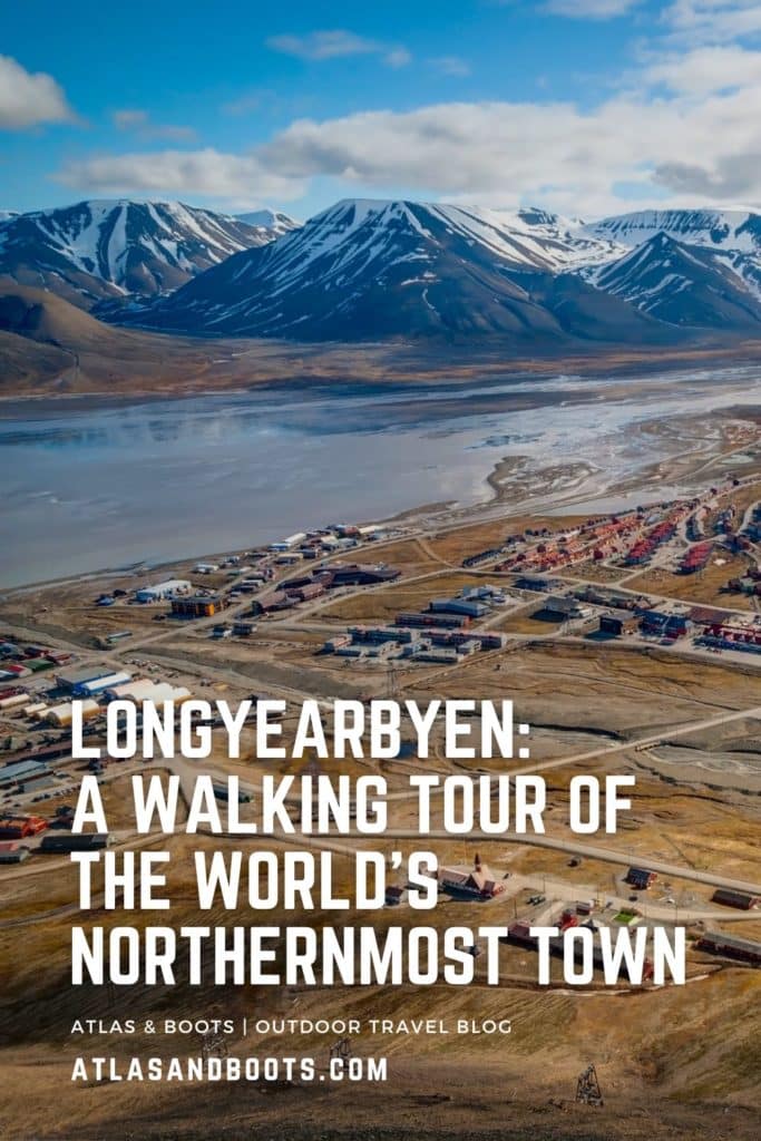
Longyearbyen, the world’s northernmost town, is easily seen on foot. We share our tried-and-tested route for exploring this remote outpost
It’s okay. You didn’t come all the way to Svalbard, anchored in the Arctic Ocean roughly midway between the northern coast of Norway and the North Pole, to linger in Longyearbyen. You don’t need to “eat like a local” here or “get under the skin” of the destination. It’s just not that type of town.
There has never been an indigenous population in Svalbard. The first humans arrived on the archipelago just over 400 years ago to hunt and whale. As a result, local populations of wildlife were decimated with several species brought to the brink of extinction.
Fortunately, decades of conservation work have seen vast tracts of land protected and wildlife numbers begin to recover. As such, these days, Svalbard is mainly an outpost for Arctic research and a destination for curious tourists.
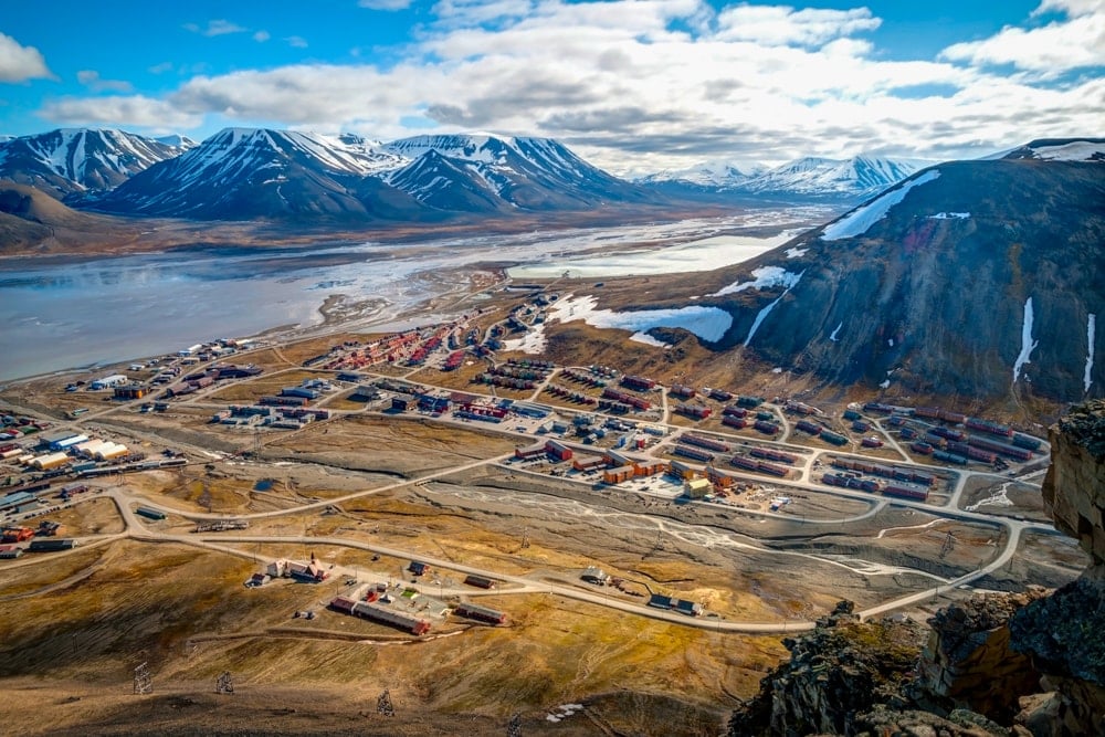
While Longyearbyen’s colourful buildings are banked by hulking mountains and two glaciers, the town is seldom described as beautiful. On a still, sunny day, under blue skies, the town can be photogenic, particularly when viewed from a distance across the water. But up close, like many remote outposts in the far north, its industrial pre-fab buildings, crumbling mining heritage and proliferation of shipping containers give it a distinctly scruffy feel. And when the clouds roll in and the sun sulks ever lower on the horizon, the town can feel distinctly bleak.
What makes Longyearbyen so alluring is not how it looks but what it promises: a gateway to a sub-polar world of remarkable wildlife and magical seascapes. The ‘Longyear Town’ is where the adventure begins.
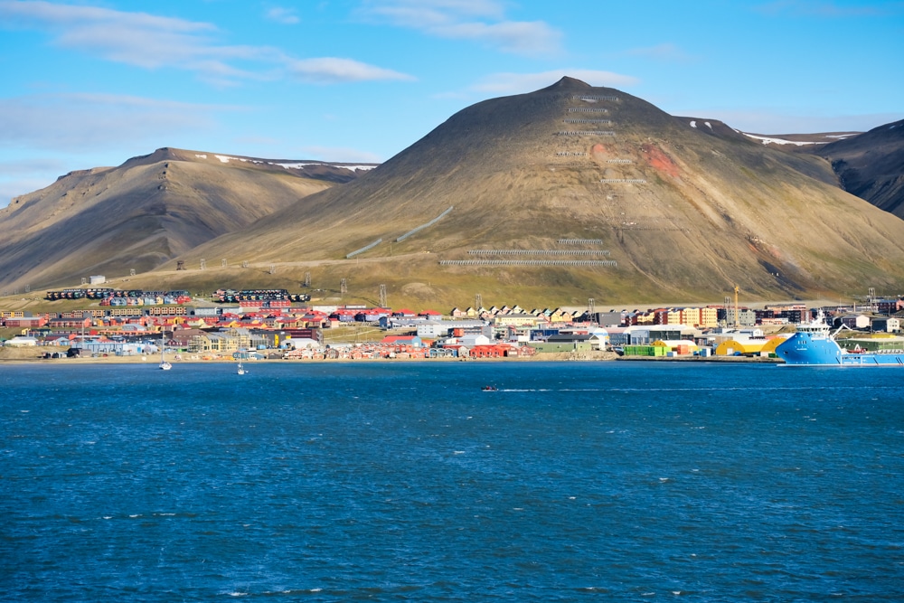
Tourists usually arrive in Longyearbyen to either join an expedition voyage (as we did), and so only have a few hours at the bookends of their trip, or they’re using the town as a base for launching Arctic excursions such as hiking, snowmobiling, kayaking, ice-caving, dog-sledging and wildlife viewing among others.
The town is deserving of a half-day walkabout and has a handful of sites worthy of a visit, even if it’s only to grab a photo of yourself in the world’s most northerly [insert landmark here].
Is Longyearbyen really the world’s northernmost town?
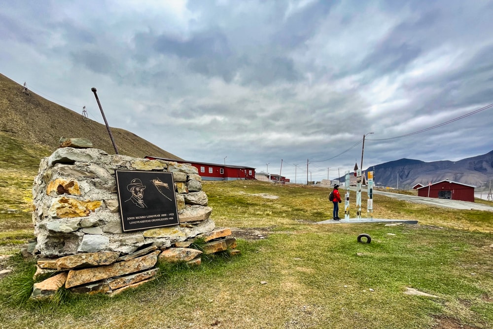
Longyearbyen was named after American John Munro Longyear who established the town after his Arctic Coal Company began mining the region in 1906. Known as the ‘Longyear Town’, Longyearbyen is Svalbard’s most populous and largest inhabited area, and the archipelago’s de facto capital.
The town is positioned on the shore of Adventfjorden, a wide bay branching off the much larger inlet of Isfjorden on the west coast of Spitsbergen, the largest island in Svalbard. The town extends from the shore up the Longyear Valley where the two glaciers of Longyearbreen and Lars Hjertabreen descend from Svalbard’s frozen interior.
At 78°13′ N, just 1,316km (818mi) from the North Pole, Longyearbyen is the world’s northernmost settlement with a population greater than 1,000. The town experiences the midnight sun for 127 days from mid-April to late August and, conversely, the polar night for 111 days from late October to mid-February.
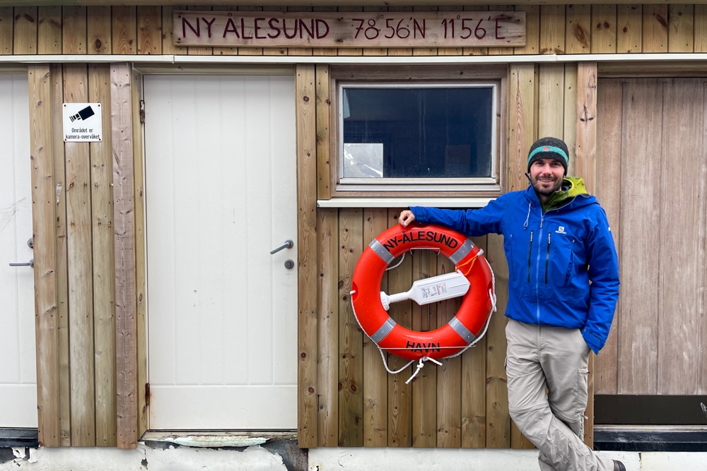
Svalbard is also home to Ny-Ålesund, the world’s northernmost permanent settlement overall. Situated at 78°56′ N, the population is a mere 35 people year-round and 114 in the summer. Given the town’s unique setting, it’s an ideal place for scientists and researchers to monitor Arctic systems and global changes. Ny-Ålesund is also home to the world’s northernmost post office.
There are other settlements farther north – in Canada, Russia and Greenland – but these are either only temporarily populated (i.e for part of the year) or have no permanent residents (i.e. are populated year-round but by rotating groups of researchers or military personnel).
The military facility of Alert on Ellesmere Island in Canada, located at 82°28′ N, is the world’s northernmost year-round settlement but, unlike Longyearbyen and Ny-Ålesund, it doesn’t have any permanent residents.
Longyearbyen: A DIY WALKING TOUR
Start: Visit Svalbard (Tourist Information)
Finish: Lompen Senteret shopping centre
Distance: 10km (6.2mi)
Time: 4-5 hours
Points of interest
In case you miss the signs, remember this is polar bear country and visitors must not leave the confines of the capital without a trained guide with a licensed firearm. It’s also worth noting that visitors are expected to remove their shoes before entering museums, hotels and restaurants – a tradition dating back to the old days when locals’ shoes were usually coated with coal dust.
- Svalbard Tourist Information – Visit Svalbard
- Longyearbyen Public Library
- Svalbard Museum
- North Pole Expedition Museum
- Longyearbyen Harbour
- Longyear Energiverk
- Cable Car Station
- Office of the Governor of Svalbard
- Sundial
- War Memorial
- Svalbard Church
- Old Longyearbyen (and cemetery)
- Huset Restaurant
- Nybyen
- End of the road
- Mine No. 2 (Gruve 2)
- Longyearbyen School
- Fruene AS, Lompen Senteret
Downtown
Begin your DIY walking tour of Longyearbyen at the Visit Svalbard Tourist Information Centre in the town centre. Here, you can pick up a city map of Longyearbyen as well as other bits of information and souvenirs. Head along the pedestrianised area towards the waterfront passing the supermarket, shopping centre and Longyearbyen Public Library, the world’s northernmost library.
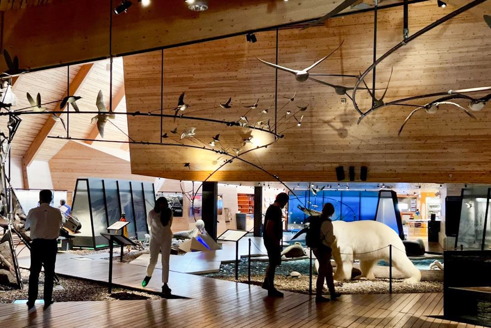
Continue towards the University Centre, where you’ll find the Svalbard Museum which is Longyearbyen’s best attraction. The outstanding exhibition space has interactive displays on Svalbard’s 400-year history covering whaling, trapping, seal and walrus hunting and, more recently, mining. There are also exhibits on local wildlife and artefacts.
Just around the corner is the North Pole Expedition Museum which covers Norway’s – among other nations’ – rich and successful history of polar exploration. The private museum houses an absorbing collection of artefacts, original newspapers and digital displays including archive footage of national heroes such as Amundsen and Nansen.
Along the waterfront
From the museum, keep the sea on your right and follow the shoreside road out to the Port of Longyearbyen. While it’s hardly the prettiest walk – the waterfront is lined with shipping containers and industrial buildings – you can find a polar bear sign just beyond the turn-off for the main dock which makes for a classic photo-op.
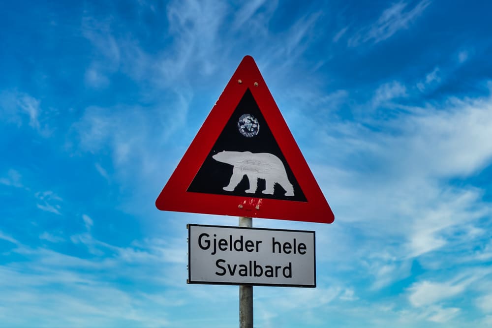
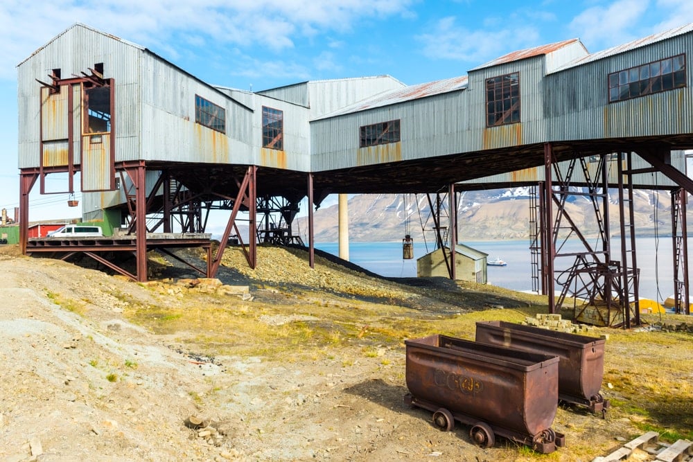
On your return from the port, you’ll pass Longyearbyen Energiverk, Norway’s only coal-fired power plant still in operation. Once beyond the power plant, turn right and head up the valley. Along the road, you’ll pass a series of noteworthy landmarks including the rusting cable car station, once used to process coal; the futuristic administrative building that houses the Governor of Svalbard’s Office; a sundial featuring a tiny polar bear that casts a shadow onto the dial; and a war memorial to those who died during the various military operations in Svalbard during World War II.
Up the valley
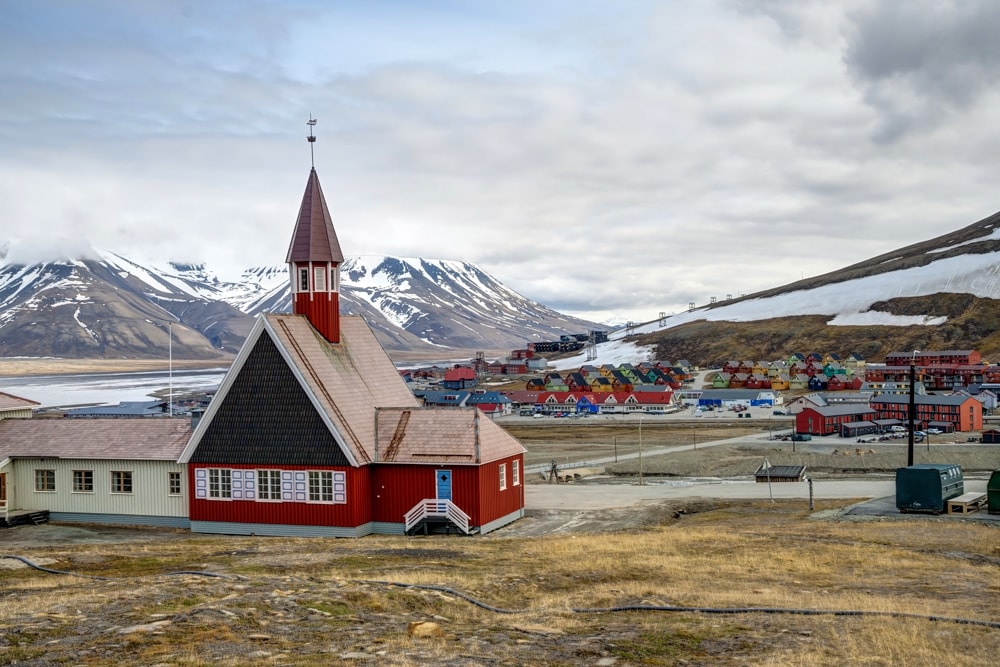
The next stop is Svalbard Church, once the world’s northernmost church. However, since the diminutive Church of St. Nicholas the Miracle Worker was erected at a Russian military base on Franz Josef Land in 2017, Svalbard Church is now merely the world’s northernmost Lutheran church. There is a small self-service cafe upstairs with comfortable lounge seats.
Further up the valley is Old Longyearbyen featuring a haunting little graveyard made up of simple white wooden crosses. Dating from the early 20th century, the cemetery includes the bodies of seven young men who died from Spanish flu in 1918.
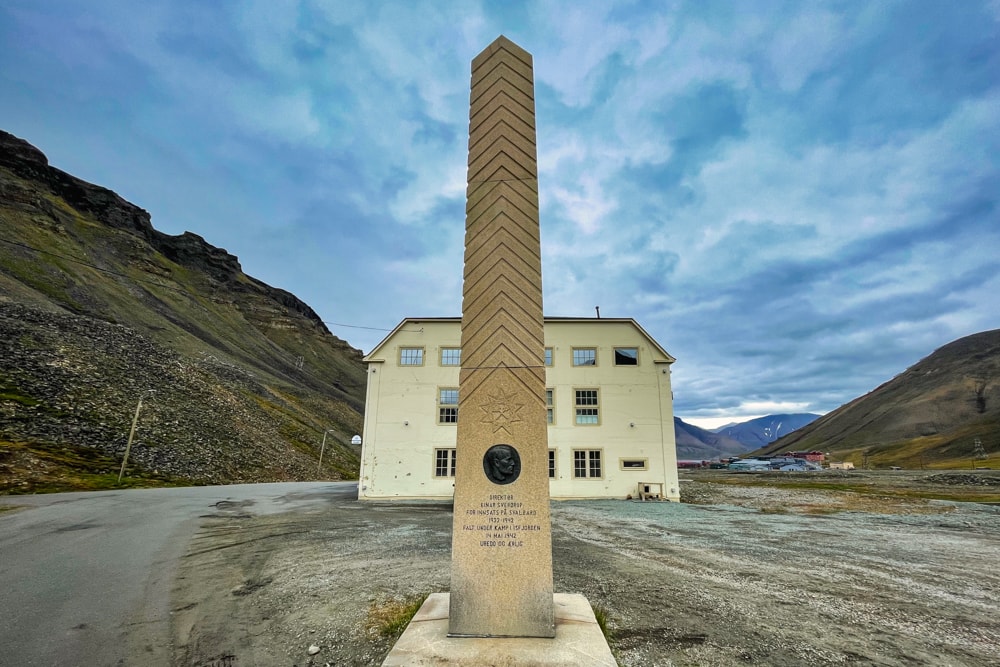
The boutique restaurant and bistro Huset is positioned on the curve of the road ahead. The restaurant is famed for its Nordic tasting menu and 15,000-bottle wine cellar – one of Scandinavia’s largest. Outside the lonely building is a simple stone obelisk to Einar Sverdrup, a mining engineer who died during World War II.
As you continue along the valley you’ll reach Nybyen, which means New Town but is not really new anymore. The suburb was founded in 1946 for the miners of Mine No. 2 and was at one point considered the commercial centre of Longyearbyen, boasting the settlement’s only shop. However, as the commercial centre moved downtown, most of Nybyen’s buildings were converted to student accommodation as well as a handful of guesthouses, restaurants and even an art gallery.
The end of the road
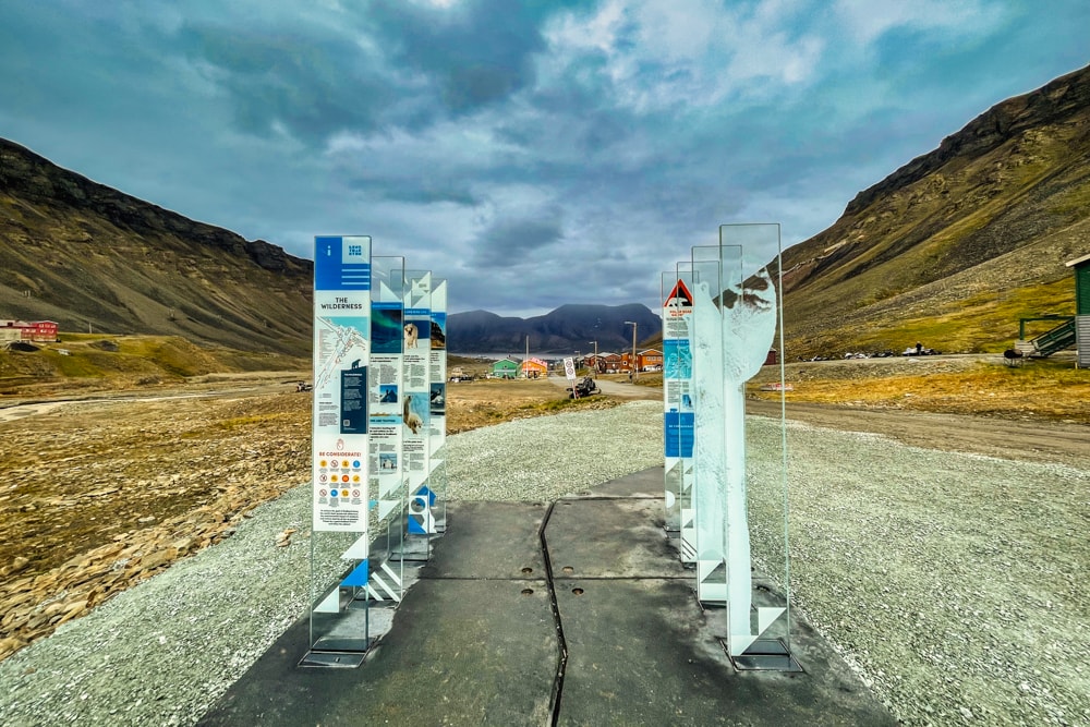
Shortly afterwards, you’ll arrive at the end of the road where a small car park is marked with some interpretive display boards and the obligatory polar bear sign, informing you not to go any further without an armed guard. From here, you can see the two glacier tongues, Longyearbreen and Lars Hjertabreen, and look back towards the water over the entire town.
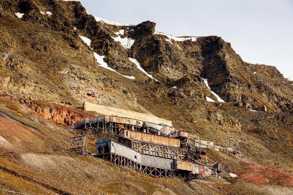
The walk back to town offers expansive views of the abandoned coal mine, known simply as Mine No. 2, off to the right. The ruins of the now-defunct mine which operated from 1913 to 1964 are spread across the lower slope of Mount Gruvefjellet.
En route to the town centre, you’ll pass Longyearbyen School, which – you guessed it – is the world’s northernmost school. Finish your walk at the Lompen Senteret shopping centre for a browse around the shops. We recommend stopping by Fruene AS cafe for a hot drink and an enormous slice of apple cake.
Further afield
Longyearbyen is home to the Global Seed Vault, a secure facility that stores over 1.1m seed samples in case a global cataclysm causes all crops to fail. For obvious reasons, the Global Seed Vault is not open to visitors but there are organised tours that will take clients close to its entrance.
The above can be coupled with a visit to Mine No. 3, another of the island’s now abandoned coal mines. Operations at Mine No. 3 ceased in 1996, but visitors can still tour the decaying facilities as well as experience a day in the life of a miner by crawling through a 300m tunnel excavated during the 1970s.
Longyearbyen: the essentials
What: A DIY walking tour of Longyearbyen in Svalbard, the world’s northernmost town.
Where: We visited Longyearbyen during our 8-day expedition to Svalbard, the last stop before the North Pole with Albatros Expeditions. We stayed in a Panorama Window Suite on the Ocean Atlantic. Albatros Expeditions’ future trips to the Arctic, however, will be aboard the new Ocean Albatros. With a total of 95 staterooms and suites, all with unobstructed sea views, most with their own balcony, the Ocean Albatros will be one of the greenest ships to venture to the Arctic.
When: The best time to visit Svalbard is June to July when the midnight sun is high in the sky and daylight never ends. June to July is also the best time to see polar bears in Svalbard.
How: We visited Longyearbyen, the world’s northernmost town, on an 8-day expedition to Svalbard, the last stop before the North Pole. Prices start at $6,590 USD per person based on two people sharing.
Discounts and promotions can be found close to departure dates. Check Adventure Life and Cruise Norway in the US, or Wildfoot, Swoop or Audley Travel in the UK.
Prices include all Zodiac cruises and landings, the Polar Plunge, rubber boot rentals, guiding and lectures, all meals on board and 24-hour tea and coffee. The kayaking excursion is extra, as is internet access though be warned that there is very little coverage given how far north you’ll be!
We flew from London to Oslo and joined Albatros Expeditions’ charter flight to Longyearbyen. Book your international flights via Skyscanner for the best prices.
